Saturday, June 14, 2008

Saturday, June 14, 2008


We woke up to sunshine in Dawson City (pop. 1,500). Dawson City is different from Dawson Creek which is the beginning of the Alaska Highway.  This was our warmest day yet starting out at 67 degrees.  Dawson City is a gold mining town.  The city is sitting on gravel and dust that was dredged up from the Yukon River bed when dredging for gold.  Dredging is the commercial way of panning for gold. 


We looked aound at the town of Dawson City for a little while today.  We saw the SS Keno which was the last steamer to run on the Yukon from Whitehorse to Dawson City where it is located now.   We also read about a boat called the Princess Sophia that sank in 1918 with 345 people on after running into a reef in the ocean.


Leaving Dawson City we took a free ferry ride across the Yukon River.  It was a little eerie after just reading about the Princess Sophia boat sinking.  Our ferry ride was great.  We drove our vehicles and campers onto the ferry.  We stayed inside our vehicles and attendants put blocks around our tires.  They ferry was long enough that our two vehicles and campers filled one lane and there were two lanes.  No one was in the other lane so we had our own private ferry ride across the river.  The river was flowing very fast so the ferry couldn’t go straight across the river.  We floated across and then the boat motored us into the current to the bank where we drove off the ferry.  It felt very strange to be sitting in our vehicle but moving sideways.  What a great experience for all of us.


We left Dawson City and took the Top of the World Highway to the Canada/US border.  The highway was in the worst condition of any highway we have been on so far.  It is correctly named,  and has some of the most beautiful views we have ever seen.  There were a number of times when Deaune would lean towards me while we were driving – there were no guard rails and the cliffs were scary.  (Tim is writing a few paragraphs while Deaune is doing laundry – she gave me a break since it is Father’s Day…)


We finally crossed the border into Alaska at 1:10 Saturday afternoon; so good to be back in the U.S.A.!  No more metrics, kilometers, or incredibly high gas prices.  The view at the crossing was unbelievable; you could probably see over 50 miles; mountain range after mountain range.  We got out and had our traditional road lunch of sandwiches and chips and walked on the tundra (we were above tree line).  It was like walking on a moon bounce or a sponge, according to Aleesha (she got tundra in her toes, but she doesn’t want me to mention that…when you see her ask her if she recovered from “tundra toe”.)


After lunch we drove to Chicken Alaska.  Not sure why it is famous, but it was a true tourist trap, for the few tourists that make it that far.  Late afternoon, we reconnected back onto the Alaska Highway (the last 3 days had been an alternate route for viewing pleasure) and were finally able to drive 60 mph.  Yes!


We arrived at Fairbanks at 10:15 and are staying at a camp called Living Water Ranch.  It is a church camp, and they have made us very welcome.  The folks who run the camp are friends of friends, and have Kansas connections.  It’s good to know people!  We dropped the campers and went into town to eat, and found a McDonalds that was still serving thru the drivethru.  The super value menu is our friend!  We were eating at midnite in the parking lot, and the sun was just setting…but it really doesn’t set, it just slides over and comes up around 4.  Amazing! 


I could handle summers here, but winter’s would be a bear with sunlight only a few hours a day.  When we go to sleep, it is still quite light out, and it never gets dark. 


Friday, June 13, 2008

Friday, June 13, 2008

Tim and Doug cooked pancakes while Deaune and Becky ran. It is always nice to have a warm meal. The temperature this morning is 53 degrees according to the thermometer in the suburban so it was perfect weather for a run. The younger kids went to the playground this morning after eating breakfast while the older kids helped with clean up and breaking down camp. They have motivation this morning as we told them they could get on-line after they were done. They can really get their work done fast when they want to.

Our Internet access seems to be pretty sporadic. Sometimes we find a campground with Internet but it isn’t a strong signal so we can get online but can’t stay connected very long.

Our drive today (Lord willing) is planned to be from the Continental Divide, YT (between Watson Lake and Whitehorse) to Dawson City, YT.

Our Milepost book says the Continental Divide where we stayed last night divides 2 of the largest drainage systems in North America—the Yukon River and Mackenzie River watersheds. Water draining west from this point drain into the Yukon River and continue a northwest journey of 2,300 miles to the Bering Sea (Pacific Ocean). Water that drains to the east forms the Rancheria River which flows into the Liard River (the Hot Springs river) and then the Mackenzie River. These waters flow northward and empty in the Beaufort Sea (Artic Ocean) after a journey of 2,650 miles.

The drive leaving from the Continental Divide to Teslin, YT was very dusty. The road was so dusty that when a semi (going the opposite direction) passed us we could not see for a little while. We couldn’t even see the lines on the road; it was a little scary. Then there was a street sweeper that was cleaning the opposite lane. Again we could not see anything at all. Several of the campsites have advertised that they have RV washes and now we see why.

The scenery today has been beautiful and the weather has been very nice. We have driven into a few sprinkles along the way but most of the day we have been in sunshine. At Whitehorse, we found the first Wal-Mart and chain stores/restaurants since Dawson Creek (almost 900 miles and two day of driving). Wow that is a lot of area without a real grocery store or fast food restaurant.

At Whitehorse we took the Klondike Loop north to Dawson City. This road had permafrost heaves (or at least what we think were permafrost heaves)


The only wildlife we have seen today has been about a dozen bunnies running for their lives to get off the road.

Thursday, June 12, 2008

Thursday, June 12, 2008

We started the day at the Northern Rockies Lodge and Campground.  It is right on the shore of the Muncho Lake.  The Muncho Lake is known for its fishing and blue-green waters.  The weather is beautiful today and the sun came up very early.  I am not sure how early because our clock’s battery is dead.  There are two floatplanes at the campground and they both took off before 9:00 this morning so we got to see them take off.  Deaune got to run and oh was it nice after sitting in the car for so many days.  Sarah fished with her cousins and they got some bites but the fish got away before they could get a fish to the shore.   They said it was great to get to fish even if they didn’t catch anything.

We have gone 3000 miles since we left home as of 10:00 am PST today.  Not all of those miles have been on the highway driving to Alaska but most of them are.  WOW, we have never been this far away from home.  It really doesn’t seem like we could be that far from home. 

After a delicious breakfast of Corn Flakes and juice we went to Liard River Hot Springs.  It was only about 15 minutes from our campground where we stayed.  Chris saw a little bear in the ditch beside the road right after we left the campground but we didn’t stop and the rest of us didn’t see him. 

The water at Liard River Hot Springs is very warm so we got out our swimming suits and went for a dip in the springs. We had to walk ½ mile on a boardwalk to the hot springs. The boardwalk went over some marshy land with very clear shallow water, which reminded us of Yellowstone.  There were little minnow-sized fish in the shallow marshy waters.  After we got to the springs everyone got in but the water was so hot that it took some time getting used to it.  Aleesha wasn’t too sure she wanted to be in the spring water because it is a sulfur spring and smelled like it.  She didn’t want to smell like that for the rest of the day and they didn’t have showers.  She finally got in and had a good time with her family. There were three different pools each had water a different temperature but all were hot. The hot springs had water that was about waist deep and had gravel on the bottom. The length of the springs was probably less than 50 yards and the width was less than 20 yards.   It had the hottest water on one end and a little creek that was cold on the other end. I don’t know how there could be such extreme water temperature changes in that small area. There was a log that spanned the width of the hot springs and we took turns playing “king of the log.”  One area of hot springs was so hot that it was hard to stand in it.  The tradition of these springs is that you get a rock from the spring’s floor and place it on a rock pile on the far side of the hottest area.  You have to cross the hottest area to accomplish this great feat.  Everyone in our group put a rock on the pile except Aleesha.  Sarah swam in the coolest pool like it was a swimming pool.  We all had a great time.

We had lunch at the Hot Springs and put our wet things on the picnic tables to dry.  The humidity level here is so low that our things dried quite a bit while we ate our lunch.

Just outside the gate of Laird Hot Springs we encountered a problem with the camper’s tire.  Some of the lug nuts were loose.  The weather was beautiful so it was a good day to be broke down for a bit.  We have had some rainy days that would have made changing a tire a mess with all the traffic passing us and throwing up dirty water.  An old mechanic named Homer helped us out fixing the lug nuts so they were tight against the tire and he only charged us $20.  We were so blessed today that our breakdown was not serious.  It did make us think about how bad a breakdown could be out here in the middle of no-where.  When we broke down, the next repair shop was 150 miles away and that is only a town with a population of 1,500.  Our Milepost recommends getting repairs down in Whitehorse, which is, a bigger town but it is 410 miles away.

Since there are not any towns on this section of the Alaska Highway, we are paying a small fortune for gasoline.  In a stretch of highway maybe 100 miles or more long there might only be two or three places along the side of the road to get gas.  These are little spots in the road where you could camp, lodge, gas up, and get a bite to eat.  The costs for any of their services are very high, as they know that they have no competition and can charge what they want. 

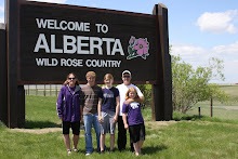
It is interesting to note that we have seven children in our two families and we have not seen hardly any other children in since Calgary, Alberta.  We have seen a few people with little toddlers and babies but the school-aged and teenagers have not been in the areas where we have been.  Canada’s schools are in session until the end of June but we thought we would see children from other areas traveling in Canada.

The Alaska Highway is about as wide as 24 Highway and it is mostly asphalt with gravel on top like our street back home but the scenery is very different.  We have been driving the last two days in the Northern Rocky Mountains of Canada and they are beautiful.  We have seen 4 black bears and 1 cub, 1 brown bear, 4 horses, and several buffalo as we drove today. 

The drive from Dawson Creek to Watson Lake has been so pretty.  We have driven through the Rocky Mountains some covered in snow.  We have seen beautiful lakes, creeks, and rivers along the side of the road.  The area is heavily treed which we would call forests but we haven’t seen signs saying that we are in a forest.  And of course we have seen animals that we don’t usually get to see except at a zoo.  Most days we have had both rain and sun.  It has been nice that when we have had rain it hasn’t caused us too much problem.

We stopped at the Sign Post Forrest, which is also the Visitor’s Center in the town of Watson Lake.  The Sign Post Forrest is an area where there are thousands of signposts from all over the world.  Anyone can put up a sign from his or her hometown. The Sign Post Forrest began in 1942 during WW II and the construction of the Alaska Highway. The American Army posted directions for the soldiers to various points of interest in the Yukon and then added signs for New York, Chicago and Tokyo.  A homesick soldier added his own signpost with the distance to his hometown.  Since then thousands have added their signpost naming places all over the world.

We ate supper at Watson Lake at a little restaurant/convenience store across the street from the Sign Post Forrest.  Their hamburgers were $9 or $10 so we had chicken which was a little less expensive for our family, $32 for all of us. We had fried chicken and mojos.  Mojos are potato wedges that are deep fat fried and seasoned.  They were very good.  Since we are no longer around any sizable grocery stores, our food expenses are very high.  When we do find a grocery store, the prices are about twice what they would be at home.  The store we went to last night had dusty boxes and cans of food on the shelves. It made us wonder how long they had been on the shelves.  We are all healthy and eating pretty well.  No one is complaining about the food which is nice because everyday it is cereal for breakfast and sandwiches for lunch.  As we try to travel and see as much as we can, there is just not time for preparing hot food.

The road north of Watson Lake is lined with hundreds of stone messages on the sides of the road.  There are people’s names and messages like “Will you marry me?” made out of stones for many miles down the road.

We drove a little more than an hour down the road to Continental Divide Campground where we stayed the night.  They had a place where we could was our vehicles so Tim and Doug took advantage of that.  Even though we are driving on pavement, it has gravel patches in places and sometimes it is very dusty so our vehicles were covered in dust.

The campground was nice and had a playground that our kids enjoyed.  They also had free firewood but we were ready to call it a night so we showered and then went to bed in daylight. 

Driving today was from Muncho Lake, BC to Continental Divide, Yukon

Mileage for the day: 261

Temperature high: 70

Camping fee: $25.00

Price for gasoline: $1.42.9/liter to 1.66.9/liter


Wednesday, June 11, 2008

Wednesday, June 11, 2008


Tim went to the auto parts store early this morning to get some oil for the vehicle and found out the time was one hour earlier than we expected.  I guess we crossed into Pacific Time zone yesterday and didn’t even know it.  We had cereal and juice for breakfast.


Today we get on the Alaskan Highway as it begins here in Dawson Creek, British Colombia.  There is a place in town at the official beginning of the Alaskan Highway called Mile 0 so we had to get our picture taken there.  There were many people getting their picture taken so we asked someone to take a picture of our whole group. 


The Alaskan Highway was built in 1942 to be a military highway.


The Alaskan Highway is a two-lane road and so far it have been paved with some areas very nice with a shoulder and other places there is no shoulder.  We went through one area that didn’t have any markings on the road for the centerline or the edges of the road.  There has been a little bit of construction.  Of course since this is only a two-lane road, any construction reduces the road to one lane and means we have to stop and wait for our turn.  Some parts of the road are gravel and we are not sure whether that is temporary until it can be fixed or if it is fixed.  We are currently stopped at a construction site and they told us it would be a five to ten minute wait. They are filling a very large chuckhole with gravel.  We are actually waiting for the work to be done not waiting for our turn with the traffic.  The chuckhole is one lane wide and the equipment is in the other lane so we will wait until they are finished before we proceed.


Our first stop this morning was at the Shepherd Inn where they specialize in fresh baked items.  Their baked goods were very big so we decided there would be enough for everyone to have a taste.  We bought a cinnamon roll, a blueberry muffin, a raspberry bar, and a no bake cookie.  They were delicious and worth the stop.


There are signs all along the highway warning us to watch out for wildlife but most of the way the signs have seemed like they were teasing us.  We have heard that there are bears, caribou, deer, stone sheep, elk, and moose.  We got to see stone sheep, deer and a moose.  The moose was actually in the road in front of the vehicle ahead of us.  Once the moose decided to move, he tried to run and it appears that God didn’t make them for running quickly or for great distances like horses.  The moose ran like he was pretty uncoordinated.


Becky remembered Muncho Lake as a place her family went to when she was a child.  They also went to Liard River Hot Springs so we are planning to go there tomorrow.


We have been driving most of the evening in beautiful sunshine but when we got the our final destination (our campground) it started raining and the temperature was cold so we were sad that we would have to set up camp in the rain.  After we registered and pulled the campers around to the campsite the rain quit and we got to set up camp without rain.  Thank you God. 


We cooked spaghetti over our camp stoves and had French bread, corn, salad, carrot and celery sticks and it was the best meal we have had for a few days. 


Driving today was from Dawson Creek to Muncho Lake.


Mileage for the day: 457

Temperature high: 60’s

Camping fee: $34.00

Price for gasoline: $1.66.9/liter

Tuesday, June 10, 2008

Tuesday, June 10, 2008 

This morning on the way to the wash room (that’s what it is called up here), we got to see an elk sitting not far from our campsite.  It stayed there for a few hours chewing the cud.  When it got up to leave, we could see there was a baby with it.  It wasn’t long before another momma elk and her baby joined them to walk around the campground.  The babies were eating grass but stayed very close to their moms.  We feel very blessed to have seen so many animals in the last 24 hours.  The campground staff told us it is calving season.  I don’t think these babies were very old.

We stayed at a very nice campground last night. There was a small creek running at the side of our campsite.  We had a cross a little bridge to get to the washrooms.  After breakfast we showered and then packed up to get on the road again.  We stopped in Jasper to get gas and a few groceries.  Gas was 136.9/liter and milk was almost $5.00/gal.  Ouch!!

We left Jasper on highway 16 to go to Hinton and then north to Great Prairie and Dawson Creek.  Not far from Jasper we saw several elk in a grassy area and then a few more miles down the road we got to see a moose and then a momma moose and her baby.  The baby was so cute. It stayed very close to its mom and followed wherever she went.  It would be great to know how old the baby was. It didn’t appear to be very old.

It was rainy today with a few periods of sunshine. We are so glad that if it was going to rain it rained today instead of yesterday when we were driving through the ice fields.  We wouldn’t have been able to see the mountaintops and the glaciers if it had been very cloudy.  We still can’t believe the blessing yesterday of seeing so many animals roaming wild by the roadside.

We stopped today for a picnic lunch in the Rocky Mountains at the Pierre Grey’s Lake Provincial Recreation Area.  There was a pit toilet and a picnic table.  We had our usual sandwiches.  Each day we get different chips to give us some variety.  How did those Israelites eat manna every day for 40 years?  It quit raining for a little while so we could have lunch. 

When we got to Grande Prairie, Alberta we found a Wal-Mart.  We were so excited and we all went inside.  We hadn’t seen a Wal-Mart since we left the USA.  It looked just like an old Wal-Mart in the US. 

Most of today was driving and the scenery was pretty driving through the Rocky Mountains.  After we got out of the Rocky Mountains, there were rolling hills with trees on them.

We stopped for the night at Dawson Creek.  Again we stopped late enough that everyone was starved so we had McDonalds, as they are much quicker than cooking over a campfire.  We stayed the night at Mile 0 Campground.  It is in Dawson Creek that we get on the Alaskan Highway.  Of course we have many miles to go to actually get to Alaska but we are enjoying the scenery on the way.

Mileage for the day: 360

Temperature high: 50’s

Camping fee: $23.00

Price for gasoline: $1.38.9/liter

Monday, June 9, 2008


Monday, June 9, 2008


It was really cold last night here in Banff.  We could see our breath when we exhaled.  After our scrambled egg and toast breakfast, we took a hike around the lake at the campground.  We got to see a bald eagle flying over the lake and then land in a pine tree near the shore.  When we got back to camp, we packed up to leave the Banff area and head toward Alaska.


We made a few stops in Banff so Doug’s family could see the Banff Springs Hotel (the princess castle) and the Cascade Falls.  We made sandwiches for lunch at Cascade Falls and then went north on Highways 1 and 93, which is also called the Icefields Parkway to Lake Louise and then to Jasper for the night.


The drive was incredible.  We drove through the Canadian Rocky Mountains and got to see lots of sites and animals.  The skies were blue with some beautiful white fluffy clouds so we could see the tops of the mountains.  Every few miles we got to see animals beside the road.  We saw black bears, mountains goats, elk, beavers, and big horn sheep.  All these animals were close to the road so that we got to see them very well.  There were five different places that we saw black bears and cubs, one lying beside the road eating grass so we just watched him for a while.  We were on the other side of the road in our vehicle.  If we had been going the other direction, it would have been too dangerous to even stop because the bear was right by the edge of the road and the shoulders of the road are not very big.  Each time we got to see an animal, we were able to stop the vehicles and watch them for a little while.  God must have had a good time making all the different kinds, shapes and sizes of animals. The kids tallied up how many animals we saw.  There were 8 black bears, too many elk to count, 1 mountain goat, 7 big horn sheep, and 2 beavers.  We also saw beautiful mountains some with glaciers in them.  The lakes are bluish green colored waters because of the glacial melt and run off.  There is silt from the glaciers in the rivers so some of the rivers and creeks have a bluish milky look to them.  The photographers in our family were having a great time trying to capture some of God’s wonderful creation in pictures.

We stopped at Lake Louise for a while.  It is a lake surrounded by snow-covered mountains with glaciers.  The lake is the beautiful turquoise color and they have boats you can rent and a hotel at the lake.  The hotel is run by Fairway, which also runs the Banff Springs hotel.  There was a woman playing a harp in the lobby.  The hotel was very elegant so we walked through it just to see what was like.  We went to the top of the hotel (all 11 of us in one small elevator), which was the 9th floor to try to see out over the lake, but there were no windows in the hallway and we couldn’t see in any of the rooms.


At one stop to see a glacier, Tim was sitting in the vehicle when some people with a French accent came up to him.  They said they were trying to figure out what that was behind our vehicle (the pop up camper).  They said does it come up.  Tim said yes and the ends even come out.  They were fascinated and walked around the camper looking at it trying to figure it out. 


It snowed on us several times as we were driving through the mountains and we got to through snowballs at several of the places we stopped to see glaciers or scenery.


About 8:30 we got to Jasper, which is the end of the National Park, and we were really hungry so we found an A&W restaurant.  What a great way to end a good day with a glass of A&W Root beer.   The restaurant closed not long after we got our food and they had hot apple pies leftover from their day.  They gave them to us and we sure enjoyed them.


We found a campground that had hookups so we stopped there.  Of course all the hookup sites were taken so we stayed in the primitive campsites and God really blessed us the next morning.  We set up camp before it got dark.  The extra hours of daylight are sure helpful when traveling all day and then setting up camp in the evenings.  We had a campfire before we went to bed.  It seemed a little warmer this evening. 


Mileage for the day: 450 miles

Temperature high: 50’s

Camping fee: $36.00

Price for gasoline: $1.36.9/liter